London is set to be hit by more snow next week as the temperature is due to plummet further.
Light snow showers and sleet are forecast to break out across the capital on Wednesday (January 17) afternoon and continue into the evening, the Met Office says.
Temperatures are expected to plummet further, to below freezing early next week. Monday is due to be the coldest day, with the mercury due to drop to -3C in parts of north-west London such as Hampstead, where it is set to feel like -6C.
It follows a freezing few days in the capital, including an icy start to the day on Thursday that felt like -1C.
Elsewhere in the UK could see “significant snow” next week, the Met Office warns.
Snow already blanketed parts of the country on Monday, triggering an amber health alert by the UK Health Security Agency, which covers north-west England, the West Midlands, East Midlands and south-west England until noon on Friday.
It means that “cold weather impacts are likely to be felt across the whole health service for an extended period of time”.
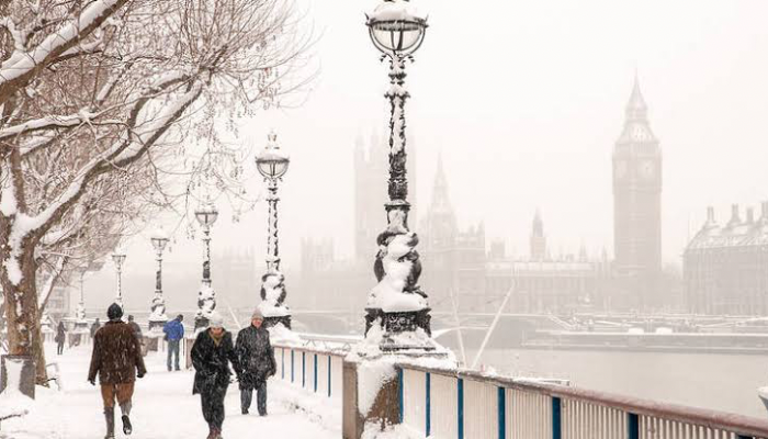
Mayor Sadiq Khan had to activate an emergency protocol aimed at taking rough sleepers off the streets as temperatures turned frosty on Monday. An ice warning was issued for London until 3am on Tuesday as the capital saw its first snow of the year.
Londoners started reporting snow falling in places like Orpington, Croydon and Beckenham from around 10.30am on Monday, with further flurries across the city continuing throughout the afternoon and into the evening.
Temperatures felt as cold as -5C in some parts of London late on Monday afternoon.
The bitter weather is caused by high pressure which is bringing colder than average weather for the time of year.
In an update on Thursday, the Met Office said “disruptive snow” was possible next week, initially in Scotland and Northern Ireland – but with “the potential for some substantial snow elsewhere”.
Met Office Deputy Chief Meteorologist David Hayter said: “While the initial snow risk from Sunday onwards is looking most likely to be coastal areas in the north of the UK, including North Sea and Irish Sea coasts, there’s an ongoing likelihood of some disruptive snow through the middle to latter part of next week.

Join BusinessDay whatsapp Channel, to stay up to date
Open In Whatsapp