
Nwegbu Ndubuisi, Director-General, Nigerian Geological Survey Agency (NGSA), said the agency had no mandate to track terrorist activities with its remote sensing application.
Ndubusi said this in an interview with newsmen after a presentation on remote sensing by Malcolm Whitworth, Director, School of Earth and Environment, University of Portsmouth of the United Kingdom on Wednesday in Abuja.
He said there were agencies saddled with the responsibility to use remote sensing to track terrorists activities or hideout; and that NGSA remote sensing application was not mandated to track terrorists but to search for minerals, vulnerable and contaminated areas.
He said that NGSA remote sensing application could provide geology and Geo-sciences information to the government and the public.
NAN reports that remote sensing is graphics software; it generates geographic information from satellite and airborne sensor data.
Remote sensing is a technology used for measuring the characteristics of an object or surface from a distance; it is used for mineral exploration and engineering, among others.
The director-general said the agency’s remote sensing could also be used to cover a wide range of geo-hazards, such as oil spill, desertification, landslide, agriculture, erosion, earth tremor.
“ These are areas that our strength could cover.
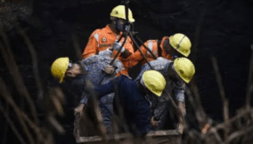
“Our remote sensing can detect all of these even where illegal mining activities are going on, it can also be used to save lives and property,’’ he said.
Ndubusi also said that the agency had produced geological maps, such as geo-chemical analysis map, vulnerability assessment map that could help companies in constructing bridges and houses, among others.
He said the agency had stations monitoring and recording earth tremor across the country in the 1980s, but that the equipment had stopped functioning due to lack of funds.
Whitworth, who also spoke to newsmen, said the Portsmouth University was collaborating with NGSA to share expertise ideas and opportunities that would be of great value to Nigeria.
“My presentation will help Nigeria to learn more on how its environment is degrading and how it can also be recovered; remote sensing is used to monitor pipeline vandalism and oil spill, among others,’’ he said

Join BusinessDay whatsapp Channel, to stay up to date
Open In Whatsapp